
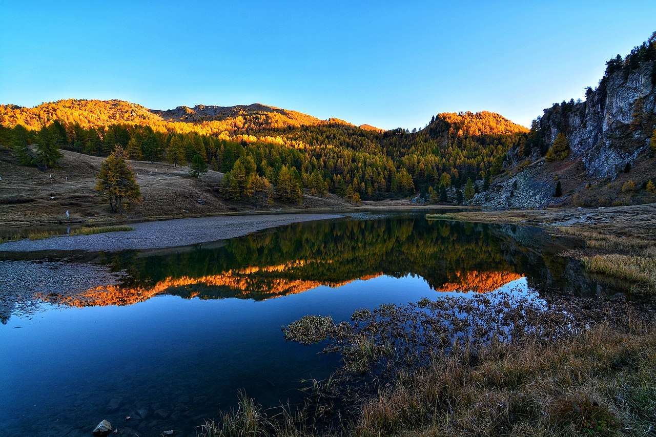
Even though the New York state gives us to the impression that it is filled with high-rising skyscrapers, we can find natural beauty within the state as well. For example, there are dozens of prominent lakes located within New York. To help you get a better understanding, we thought of sharing details with related to top 20 lakes in New York. If you are currently based in New York, or if you have any plans to visit New York, make sure that you don’t forget these lakes. They can provide an unforgettable experience to you.
[googlemaps https://www.google.com/maps/d/u/3/embed?mid=1FJLDNntPKOTqgayhK8LXCE0t71UAaOrm&w=640&h=480]
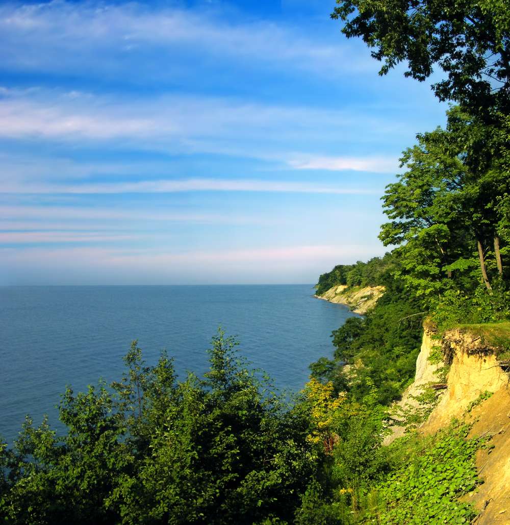
1. Lake Erie – Largest Lake in New York
Lake Erie is the largest lake that you can find in New York. This lake has a total surface area of over 9,910 square miles. On top of that, the lake has a shoreline of 368 miles. Maximum depth of the lake is 64 meters. It has a total volume of 116 cubic meters.
Although Lake Erie is the most prominent out of the Great Lakes, it also freezes over more frequently than the others.
According to the Environmental Protection Agency, it has the fourth biggest surface area of 9,910 square miles (25,700 square kilometers) and the smallest water volume of 116 cubic miles (484 cubic kilometers) (EPA).
Lake Erie, like all of the Great Lakes, is essentially a divot produced by a sliding glacier, and its current configuration is quite recent – less than 4,000 years old.
The Erie tribe and the Iroquois were among the native peoples who resided around the lake’s shores. The last of the Great Lakes to be explored by Europeans was Lake Erie.
In 1669, the lake was “found” by French explorer Louis Joliet. Lake Erie runs through four states in the United States, including New York, Pennsylvania, Ohio, and Michigan, as well as the Canadian province of Ontario.
On the eastern end is Buffalo, New York, while on the western end is Toledo, Ohio. On the southern shore, Cleveland, Ohio, and Erie, Pennsylvania, are located.
The Detroit River, as the southernmost of the Great Lakes, receives the majority of its water from the upper lakes — Lake Superior, Lake Michigan, and Lake Huron — as well as tributaries like the St. Clair River and Lake St. Clair.
Niagara Falls is its primary outflow. The Niagara River, which runs 36 miles (58 kilometers) between Lake Erie and Lake Ontario, is the source of the falls.
Lake Erie has a tail-like shape, as evidenced by its name, which is derived from the Iroquoian word erielhonan, which means “long tail.”
The lake is approximately 241 miles (388 kilometers) long, 57 miles (92 kilometers) wide, and has a total shoreline of 871 miles (1,402 kilometers), including islands.
According to the Michigan Economic Development Corporation, it is the 11th largest lake in the world.
Read: Biggest Lakes In The United States Of America [Top 20]
Learn about the Lake Superior Largest Lake in the USA
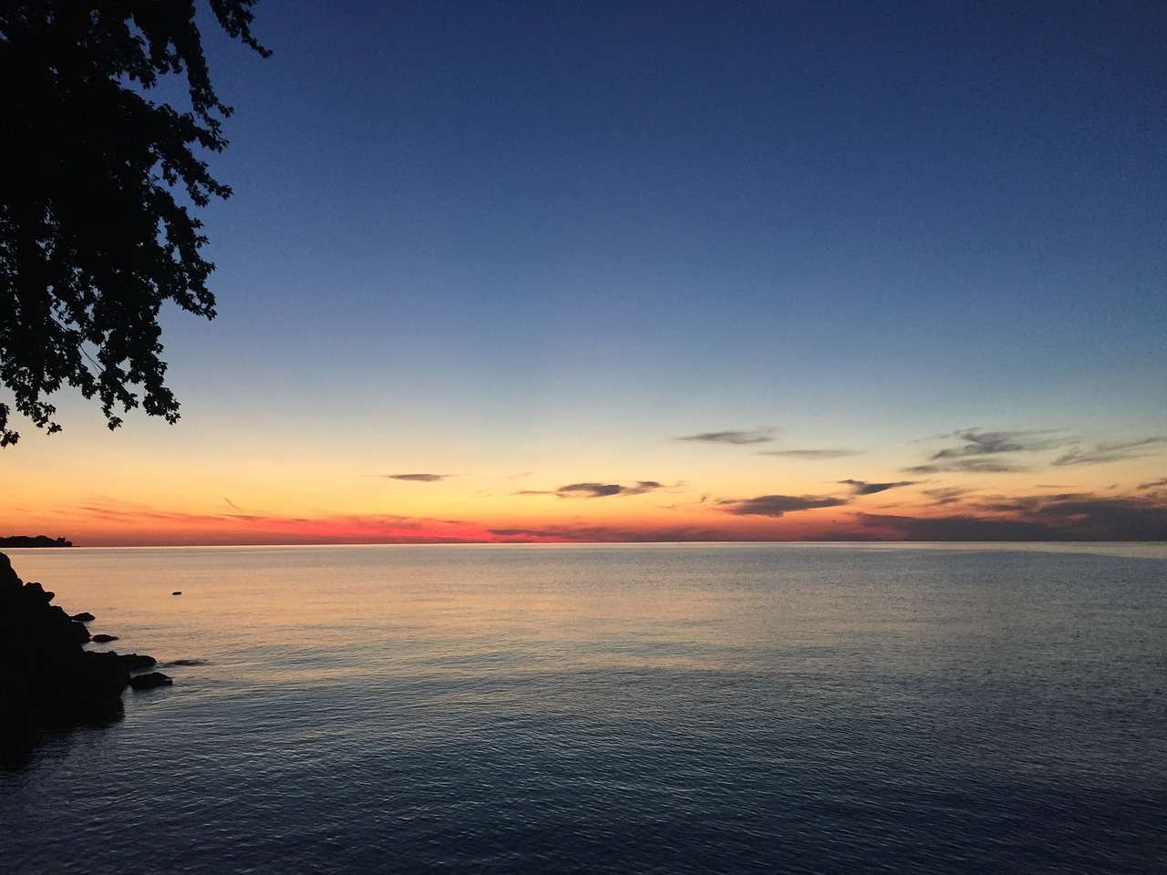
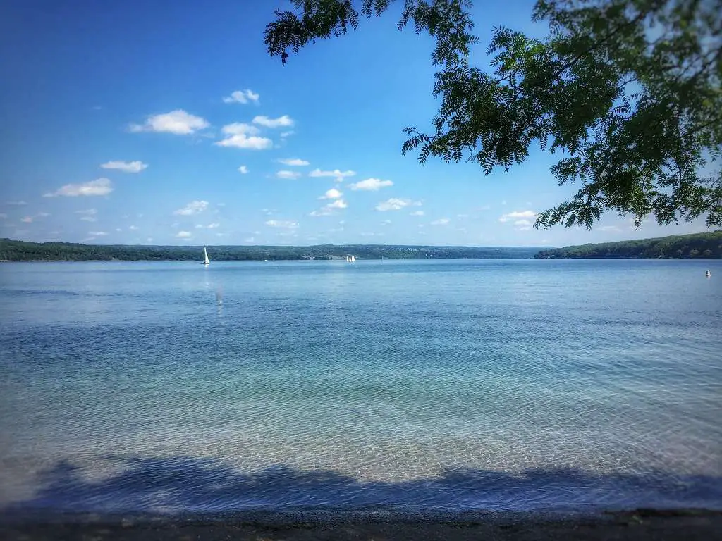
2. Lake Ontario – Largest clear clean water lake in New York
Lake Ontario is the largest lake in New York with clean water. The lake has a surface area of 7,320 square miles. Total shoreline length of the lake is 726 miles.
This lake has a water volume of 393.5 cubic miles. The maximum depth of the lake is 801 feet.
Lake Ontario, like all of the Great Lakes, evolved as a result of glacial shifting and melting towards the end of the last Ice Age.
Lake Ontario, the easternmost of the Great Lakes, is located at the base of the Niagara Falls.
It is bordered on the southwest and north by Ontario, Canada, and on the south by New York. The lake’s outflow to the Atlantic Ocean is the St. Lawrence River.
There are several lagoons and baymouth bars on the lake, which are sand, mud, or other debris deposits that shut off bay regions.
There are several islands on the lake, notably the Thousand Islands area, which is a roughly 2,000-island archipelago that runs along the US-Canada border.
While many of the islands are tiny or uninhabited, Wolfe Island is the biggest. It covers an area of 48 square miles (124 square km). Of the five Great Lakes, Lake Ontario may be the most polluted.
It receives pollutants from all of the other lakes that drain into it.
According to the University of Wisconsin Sea Grant Institute, it also gets runoff from nearby farms and businesses.
The name of the lake is derived from an Iroquois term that means “beautiful lake.”
Étienne Brulé, a French explorer and protégé of Samuel de Champlain, was the first European to reach Lake Ontario.
According to the Canadian Museum of History, Brûlé arrived at Lake Huron and Lake Ontario about 1615.
The French erected forts around the lake’s shores in the 17th and early 18th century.
The lake has a long history of business and trade, particularly after the War of 1812, when canals were erected, and large steamships plied the waters.
Until railroads were developed, and steamers were replaced as a mode of transportation, the lake was a commercial centre.
Some of the species that swim in Lake Ontario’s waters include walleye, Coho salmon, and Chinook salmon, as well as rainbow and steelhead trout.
Invasive mussels have taken up most of the lake’s bottom in the coastal sections.
The climate around Lake Ontario is ideal for fruit trees, and the region has become a significant producer of apples, cherries, peaches, pears, and plums.
Learn about the largest natural lake in Texas
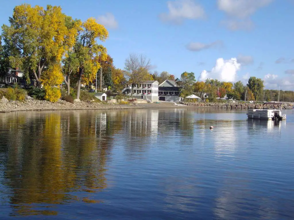
3. Lake Champlain – largest natural freshwater lake in New York
Lake Champlain is the largest freshwater lake that you can find in New York. The lake has a surface area of 490 square miles. Total shoreline length of the lake is 587 miles.
This lake has a water volume of 6.19 cubic miles. The maximum depth of the lake is 400 feet.
Lake Champlain is difficult not to fall in love with, owing to its visual splendor and recreational opportunities.
However, there are a slew of other variables that might help you appreciate this gorgeous body of water even more.
Let me share a few of these things with you; some of them might even come in handy in a future trivia game.
Lake Champlain, the sixth biggest body of water in the United States, was named one of the Great Lakes in 1998, but only for roughly 18 days.
On March 6th, 1998, President Clinton signed a law, however it was withdrawn 18 days later on March 24th.
It appears that turning Lake Champlain into a “collection of lakes” did not sit well with the majority of the people who live near this body of water.
Lake Champlain, they believed, was distinctive and deserved to be recognized as a “great lake” in its own right.
If you put a boat in the water anywhere along this lake, you may travel to Montreal, Manhattan, or even further into the Atlantic.
Both the United States and Canada share the lake.
Lake Champlain is connected to the Richlieu and St. Lawrence Rivers to the north by the Chambly Canal.
The Champlain Canal, which runs to the south of the lake, connects it to the Hudson River.
Within the 6 million-acre Adirondack Park, Lake Champlain holds the distinction for being the lowest point. It’s only about 100 feet above sea level, but it flows 125 miles north!
There are 587 miles of shoreline, 70 islands, and 6.8 trillion gallons of water in this body of water. The lake is about 12 miles wide at its widest point and 400 feet deep.
Lake George, too, want to unite with its larger neighbor.
Lake George empties into Lake Champlain via the La Chute River at its northern end. The Lake features a vertical drop of around 220 feet, which is comparable to Niagara Falls!
It’s no surprise that Ticonderoga is constructed around a fast-flowing river.
At the Ticonderoga Heritage Museum, you may learn about Ticonderoga’s industrial development and the utilization of water power.
Around 300 shipwrecks can be found at the bottom of Lake Champlain.
Many of these can be visited in person courtesy to the Lake Champlain Historic Preserve System in New York and Vermont.
Are you not a diver? The shipwrecks can be seen and learned about at the Lake Champlain Maritime Museum.
For more than 30 years, the LCMM has been researching Lake Champlain shipwrecks.
At their museum, you can watch recorded movies taken with underwater cameras or join one of their Shipwreck Tours.
You will be transported to the site of a shipwreck aboard an excursion boat.
You can watch a remotely controlled vehicle (ROV) project images immediately onto an onboard monitor once you arrive.
Learn about the largest and deepest lake in Ohio
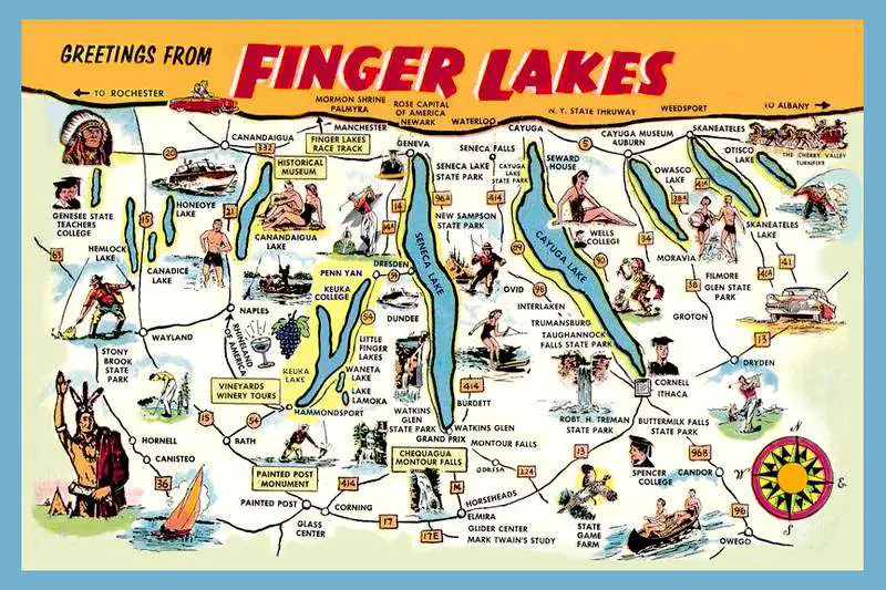
4. Finger Lakes – largest recreation and vacation lake in New York
If you are looking for the largest recreation and vacation lake in New York, you may take a look at the Finger Lakes. The lake has a surface area of 11,730 acres.
Total shoreline length of the lake is 60 miles. This lake has a water volume of 400 cubic miles. The maximum depth of the lake is 618 feet.
The Finger Lakes are a chain of lakes in Upstate New York’s centre region. They are a well-known tourist attraction.
The lakes go from north to south and are long and narrow. They’re also rather large. Lake Seneca is the deepest, at 618 feet.
The Bluff Point Stonework for example, are evidence of pre-Iroquois settlement in the Finger Lakes region, but nothing is known about who built these mysterious monuments.
The Iroquois homeland is centre in the Finger Lakes area.
The Seneca and Cayuga nations, for whom the two biggest Finger Lakes are called, are among the Iroquois tribes.
From around 1720, the Tuscarora tribe resided in the Finger Lakes region as well.
The Onondaga and Oneida tribes resided near their eponymous lakes, Oneida Lake and Onondaga Lake, on the eastern border of the area.
The Mohawk were the easternmost Iroquois tribe.
The Finger Lakes are a collection of eleven long, thin lakes that run roughly north–south in the Finger Lakes region of New York, USA.
The Finger Lakes Uplands and Gorges ecoregion of the Northern Allegheny Plateau and the Ontario Lowlands ecoregion of the Great Lakes Lowlands straddle the northern and transitional boundary of the Northern Allegheny Plateau.
As a succession of northward-flowing streams, these glacial finger lakes formed.
The Laurentide Ice Sheet’s first of many continental glaciers migrated southward from the Hudson Bay area some two million years ago, kicking off the Pleistocene glacial.
The existing river basins were expanded, deepened, and emphasized by these scouring glaciers.
Lakes formed as a result of glacial debris, perhaps terminal moraine left behind by receding ice, acting as dams.
Despite the extensive erosion of the valleys, there is no evidence of glaciation in the adjacent uplands, suggesting that the ice was thin, or at the very least unable to produce considerable erosion at these higher elevations.
The ice’s severe cutting left several rivers dangling high above the lakes, with streams hanging as high as 120 meters over the valley floors in both Seneca and Cayuga.
The Marcellus Shale and the Utica Shale, two major natural gas deposits, run across much of the Finger Lakes region.
Natural gas may now be extracted thanks to recent advancements in fracking technology.
While some big landowners have leased their properties and a handful of small landowners are considering doing so, many locals around the Finger Lakes are opposed to the fracking process because to worries about groundwater pollution and the industrial effect of extraction-related operations.
Learn about The shallowest lake in Pennsylvania
5. Lake St. Francis – largest Lake that links to the Atlantic Ocean
Some of the lakes in New York are linked along with the Atlantic Ocean, and Lake St. Francis holds a prominent place out of them.
The lake has a surface area of 102,000 acres. Total shoreline length of the lake is 540 miles. This lake has a water volume of 3.19 cubic kilometers. The maximum depth of the lake is 25 meters.
The Moses-Saunders Hydroelectric Dam on the western end and the Beauharnais Hydroelectric Dam on the eastern end were built to create Lake Saint-Francois, a major extension of the St. Lawrence River that was converted into a reservoir.
Lake St. Francis is vital to Canada’s and the New York region’s economies because its water is utilized for electricity generation and commercial transportation.
A single ship sailing through the seaway can transport the equivalent of 870 truckloads of freight at a substantially lower fuel cost.
Tourists as well as visitors with several marinas, yacht clubs, and boat launches giving convenient access to the lake, visitors should keep in mind that a buoyed channel has been dug the length of the lake to allow big commercial ships to pass, and that they should always give way to these boats.
Anglers will delight in Lake St. Francis.
The lake hosts a varied variety of warm and cold water fish due to its wide surface area.
Over 20 distinct species of sport fish, pan fish, and coarse fish have been identified via surveys.
Walleye, northern pike, muskie, lake trout, largemouth bass, smallmouth bass, king salmon, steelhead, brook trout, rainbow trout, speckled trout, perch, catfish, whitefish, and crappie are some of the most popular fish.
Lakefront housing and vacation rentals are available in villages, towns, and cities around the lake in both Canada and New York.
Motels, spas, resorts, vacation houses, cottages, villas, campsites, and bed and breakfast inns are all examples of these types of rentals.
Visit numerous places and stay in different types of overnight accommodations to truly appreciate the beauty and excitement of Lake St. Francis.
The Lac Saint-Francois National Wildlife Area, which is located on the southern coast, is a must-see for nature enthusiasts.
The marshes that are home to Red Head Ducks and other waterfowl are protected by this reserve. Migrating waterfowl use it as a layover point as well.
On the northern coast, there are two protected wetlands: Charlottenburg Marsh and Cooper Marsh.
Lake St. Francis is a multi-purpose lake that produces electricity, transports goods, is an angler’s paradise, a boating destination, a holiday retreat, and a waterfront house.
Start packing your luggage and enjoy everything it has to offer.
Learn about the largest body of water wholly contained within Illinois
6. Oneida Lake-largest Lake located entirely within the state of New York
The Oneida Lake has been able to earn reputation as the largest lake located within the New York state. The lake has a surface area of 79.8 square miles.
Total shoreline length of the lake is 55 miles. This lake has a water volume of 79.8 square miles. The maximum depth of the lake is 55 feet.
With a total size of 79.8 square miles, Oneida Lake is the biggest lake wholly inside New York State. The lake is among the Great Lakes and is located northeast of Syracuse.
It drains into Lake Ontario through the Oneida River, a tributary of the Oswego River.
The lake was part of an important waterway connecting the Atlantic seaboard of North America from the beginning until the completion of the Erie Canal in 1825.
The lake is roughly 21 miles long and 5 miles broad, with a depth of 22 feet on average. The coastline stretches for roughly 55 kilometers.
The watershed encompasses parts of six counties and 69 towns.
Oneida Creek runs through Oneida and Sherrill before emptying into the southeast corner of the lake at South Bay.
Oneida is frequently referred to as the “thumb” of the Finger Lakes, despite the fact that it is not one of them.
It is warmer in the summer than the deeper Finger Lakes due to its shallowness, and its surface freezes hard in the winter due to its shallowness.
It is generally safe and popular for ice fishing and snowmobiling in the winter.
The fish population in Oneida Lake is varied, although just a few of the 74 species recognized contribute to fisherman’ annual catch.
Rock bass, pumpkinseed sunfish, bluegills, and black crappie (locally known as “calico” or “strawberry bass”) are sought-after panfish.
Brown bullheads, white suckers, and channel catfish are popular springtime targets for fishermen.
Many Oneida trips result in the capture of drum, while burbot (often known as “lawyers”) bite mostly in the winter.
Northern pike have undergone a modest population recovery in recent years, with individuals measuring over 10 pounds being caught.
The fishing on Oneida Lake is well renowned for its walleye and golden perch.
Walleye can be found in shallow water around spawning sites and rivers in the spring. Walleyes are typically found in deeper water during the summer months.
Walleye return to the shallows as the water cools down in the fall.
This time of year, casting stick baits and blade baits from the beach after dark may be a blast.
Walleyes are also captured through the ice at shoals, drop-offs, and deep-water flats.
On Oneida Lake, ice fishing for yellow perch is quite popular, and it usually takes place in 30-40 feet of water along Deepwater flats.
Oneida Lake is a great place to go bass fishing, and the lake hosts a number of competitions every year.
Professional bass fishing organizations like BASSMASTER and FLW have made Oneida Lake a popular competition destination.
Smallmouth bass may be caught along the numerous shoals, but largemouth bass can be found in the bigger bays and everywhere there is strong plant development.
The lake is teeming with panfish. Big Bay is a notable panfish ice fishing spot and one of the lake’s first to freeze over.
The most common forage fish in the lake are young yellow perch and gizzard shad, as well as round goby.
Learn about the deepest lake in Florida
7. Seneca Lake – deepest and largest lake by volume in New York
Seneca Lake is the largest and deepest lake by volume that you can find in New York. The lake has a surface area of 66.87 square miles.
Total shoreline length of the lake is 75.4 miles. This lake has a water volume of 3.814 cubic miles. The maximum depth of the lake is 618 feet.
Seneca Lake, formerly part of the proud Seneca Nation, is one of the most popular of New York’s Finger Lakes, featuring natural scenic splendor and popular destinations and activities such as the Seneca Lake Wine Trail and Watkins Glen International Raceway.
Seneca Lake is surrounded by vineyards that cover hundreds of well-kept, scenic acres, and its gorgeous waters attract sports enthusiasts from all over the world who come to enjoy boating, fishing, sailing, and swimming.
Seneca Lake is the largest lake wholly inside the state of New York, holding more water than any other.
In terms of depth below sea level, it is also the second deepest lake in the United States. It is marketed as the world’s lake trout capital, and it hosts the National Lake Trout Derby.
Seneca Lake has been used to test submarines and underwater listening equipment due of its depth. The Seneca tribe of Native Americans gave the lake its name.
The city of Geneva, New York, is located near the northern end of Seneca Lake and is home to Hobart and William Smith Colleges as well as the New York State Agricultural Experiment Station, a branch of Cornell University.
The picturesque hamlet of Watkins Glen, New York, is located on the south end of the lake and is known for its car racing and waterfalls.
A large number of canal barges are moored at the lake’s bottom.
The Finger Lakes Underwater Preserve Association is preserving and making available for scuba diving a group of barges on the southwest end of the lake, near the hamlet of Watkins Glen.
Learn about the largest natural lake in California
8. Cayuga Lake – the second largest Finger Lake
Cayuga Lake is the second largest Finger Lake in New York. The lake has a surface area of 66.41 square miles. Total shoreline length of the lake is 95 miles.
This lake has a water volume of 2.27 cubic miles. The maximum depth of the lake is 435 feet.
Glaciers formed Cayuga Lake, as well as the Great Lakes. Massive sheets of ice cut holes in the soil as they moved southward more than 100,000 years ago.
Water flooded the vast holes when the glaciers melted. A sequence of north-to-south troughs emerged in central New York.
Finger Lakes got their name because they looked like two hands reached down and gouged them.
There are 11 Finger Lakes, ranging in size from 40 miles long Cayuga to 3 miles long Canadice.
The Seneca River is the deepest at 618 feet, while the Cayuga River is the second deepest at 435 feet. The natural beauty of the region and its lakes is well-known.
On the south end of Seneca, this is a picture of the canyons in the famous Watkins Glen State Park.
Similar features may be found in Cayuga, such as Taughannock Falls on the southern end.
The gorge’s massive fall plunges 215 feet past towering cliffs that soar nearly 400 feet above it.
The deep waters of the lake and the surrounding high hills have produced an excellent “micro-climate” for wine production.
The Cayuga Lake Wine Trail allows visitors to sample award-winning wines, see picturesque waterfalls, and dine at local restaurants.
The Elites came to Cayuga in 2014, when the event was initially planned to take place in Ithaca, on the lake’s southern tip.
However, municipal authorities determined that the event would conflict with students returning to Cornell University and Ithaca College, so they asked to be excused.
This is a view of Cornell’s West Campus from McGraw Tower.
Some of the beach has cliffs, which contribute to the attractiveness. Cayuga Lake receives water from 140 different streams.
Its waters travel north to the Seneca River, then south to Lake Ontario and the Oswego River. All but one of the Finger Lakes are connected by a vast canal system.
Water that enters Cayuga takes ten years to circulate through the lake due to its size and depth.
The anglers coo over the beauty of the lake, as well as the fishing.
Here Stephen Longboard shows nice representatives of the lake’s largemouth and smallmouth populations he caught during the 2012 Northern Open.
Greg Hackney won the Bassmaster Elite Series event on Cayuga in 2014 en route to his Toyota Angler of the Year title.
Hackney was leery of fishing to his strength in the shallow grasses on the northern end of the lake. He wanted to get away from the crowds.
He discovered a deep-grass bite in practice that suited his desires.
Learn about the lake Michigan the second-largest of the Great Lakes by volume
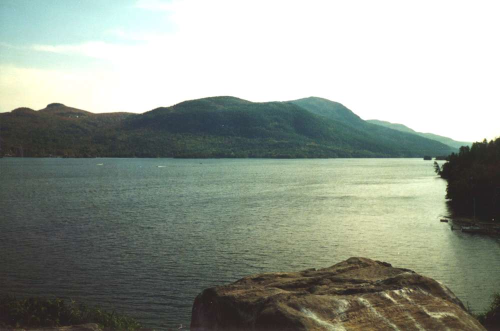
9. Lake George – Queen of American Lakes
Lake George is also considered as Queen of American Lakes. It is one of the most prominent lakes that you can find in New York as of now.
The lake has a surface area of 44 square miles. Total shoreline length of the lake is 176 miles. This lake has a water volume of 0.597 cubic miles. The maximum depth of the lake is 197 feet.
During the previous Ice Age, glaciers blanketed most of the northeast.
Glaciers began to recede and cut through rock as the planet warmed between 10,000 and 12,000 years ago, leaving silt, deposits, and ice pieces behind.
Lake George was formed as chunks of ice began to melt and water filled in the gouges along the ground.
Lake George was given the name Andia-ta-roc-te by the Mohawk, an Iroquois nation tribe, and has had several name changes since then.
Historians and locals are still arguing whether Samuel de Champlain or Isaac Jogues discovered the lake first, but in the 1600s, Jogues, a missionary, called it Lac Du Saint Sacrament, or Lake of the Blessed Sacrament.
Fast forward to the French and Indian War, when British Commander William Johnson named the waters Lake George in honor of the monarch.
There are around 186 islands in Lake George, 154 of which are state-owned with about 50 suitable for camping and another 30 or so that are privately owned.
The outflow of Lake George, which is connected to Lake Champlain, is known as the “La Chute River,” and it drops 220 feet over a mile-long sequence of falls.
Lake George has no equal in terms of natural beauty and historical significance in the United States, and its shores are devoid of commerce and industrial.
Caldwell was the original name of Lake George Village, after its founder, James Caldwell, who also provided accommodation at his log tavern on what is now Shepard Park grounds.
Lake George Village, the epicenter of exciting tourism events and activities, is situated at the southernmost tip of the world-class body of water affectionately known as the “Queen of American Lakes” because of its sparkling clear waters and breathtaking panoramas.
Lake George was featured in a two-page full-color spread in the New York Times, was recognized in the Wall Street Journal Report’s “Family Destination Segment,” and was rated number five out of twenty in “Boater’s World” as the best family boating destination!!!!
That’s not all: according to Smart Money Magazine, Lake George was ranked #1 in the East and #5 in the USA as a “popular family holiday location.”
Furthermore, the Lake George Region was named one of the finest vacation locations in the United States in a poll of over 5000 Harley Davidson riders, in part because of its picturesque roads, activities, mountain lakes, streams, as well as housing, food, and affordability.
Read: Is Traveling A Hobby? The Ultimate Guide To An Exciting Way Of Life
Learn about the Downsides Of Traveling As A Hobby
10. Great Sacandaga Lake – the largest man-made lake in New York
The largest man made lake that you can find in New York as of now is Great Sacandaga Lake. The lake has a surface area of 51.7 square miles.
Total shoreline length of the lake is 66 miles.
This lake has a water volume of 22.920 billion cubic feet. The maximum depth of the lake is 70 feet.
Great Sacandaga Lake is found in the counties of Fulton and Saratoga.
The lake was formed when the Sacandaga River was dammed to provide flood control and flow augmentation in the Hudson Valley, and it now offers a variety of recreational activities.
The lake is one of Region 5’s largest, and because of its size, it has a diverse range of species to satisfy any angler’s needs.
In 1940, a record Northern Pike was captured in New York State.
On the lake, the New York State Department of Environmental Conservation provides four boat launching.
A concrete ramp and parking for 60 vehicles and trailers are available at the Northville Boat Launch, which is located off Route 30 in the village of Northville.
A concrete ramp and parking for 40 vehicles and trailers are available at the Town of Day Boat Launch location on North Shore Road in Saratoga County.
The Northampton Beach Campground and Day Use Area offers a boat launch as well as fishing and camping opportunities on the lake.
The Broadalbin Boat Launch, located 3 miles northeast of the Village of Broadalbin on county route 110, features a hard surface ramp with parking for 60 vehicles and trailers.
Great Sacandaga Lake provides a diverse range of fishing possibilities for a number of fish species. Every year, the DEC supplies 12,000 rainbow trout into the lake’s deeper parts.
The Great Sacandaga Fish Federation stocks brown and rainbow trout that are two years old. The lake may also include brook trout and landlocked salmon.
Big northern pike may still be found, and there is a large natural population of walleye. Smallmouth bass fishing has been some of the greatest in recent years.
The Great Sacandaga Lake region, like Sacandaga Park before it, is a must-see tourist attraction for anybody seeking to get away from the city!
Locals and visitors from all over the state and nation come to the lake for pleasure, to appreciate nature, or to stay in their summer campers and seasonal residences.
The Sacandaga region provides the finest of the Adirondacks, with year-round seasonal sports such as boating and fishing in the summer and skiing and snowboarding in the winter, as well as hundreds of stores, boutiques, restaurants, and museums.
11. Chautauqua Lake – one of the highest navigable bodies of water in North America
Chautauqua Lake is one of the most prominent navigable bodies of water that you can discover out there in North America. The lake has a surface area of 53 square kilometers.
Total shoreline length of the lake is 27km. This lake has a water volume of 3.2 cubic miles. The maximum depth of the lake is 78 feet.
Bemus Point divides the lake into two basins of almost similar size.
Chautauqua Lake’s north basin is 25 feet deep on average, with a maximum depth of 75 feet.
With an average depth of 11 feet and a maximum depth of 19 feet, the south basin is significantly shallower.
The lake’s water drains to the south, first into the Chadakoin River in Jamestown, New York, and then into the Conewango Creek to the east.
The stream flows south, joining the Allegheny River near Warren, Pennsylvania, then the Ohio River in Pittsburgh, before draining into the Mississippi River.
For 10,000-12,000 years, the Chautauqua Lake Watershed has most certainly been inhabited.
However, the first substantial consequences on the lake and watershed did not occur until the nineteenth century, when deforestation and overfishing were at their height.
The Warner Dam, which was completed in 1919, is now used to partially manage lake levels. Water quality monitoring has a lengthy history at Chautauqua Lake.
The New York State Conservation Department tested the lake for the first time in 1937.
The lake is largely utilized for tourist and pleasure, such as boating and fishing.
The Chautauqua Institution, which has a broad range of shops and restaurants as well as live music and many public lectures throughout the summer months, attracts the bulk of visitors.
Musky fishing and yachting are popular activities on Chautauqua Lake.
“Sandy Bottoms” and Long Point State Park, both near Maple Springs, are two of the most popular boating spots on the lake.
It is not uncommon to see almost 100 boats in this section of the lake on busy, warm weekends. Fireworks are launched from villages all around the lake on July 4th.
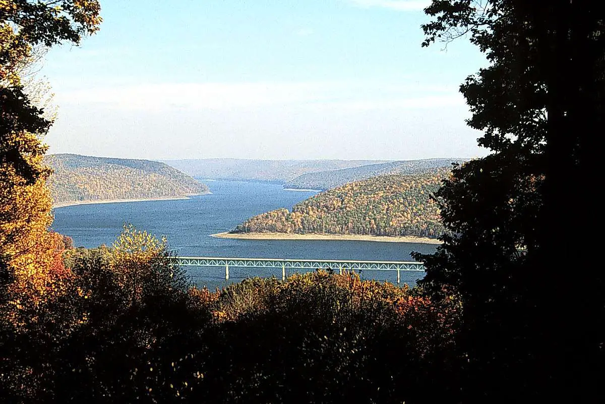
12. Allegheny Reservoir – Flowing across tree-covered hills in southwestern New York
Allegheny Reservoir is known as a lake that is flowing across tree covered hills that you can find in the Southwestern New York region as well.
The lake has a surface area of 85.7 square kilometers. Total shoreline length of the lake is 450 kilometers.
This lake has a water volume of 82 cubic miles. The maximum depth of the lake is 48 feet.
The Allegheny Reservoir, a 12,000-acre impoundment on the Pennsylvania-New York border, straddles the state line.
The Allegheny National Forest entirely surrounds the reservoir in Pennsylvania.
The reservoir is a great area for families to go fishing, boating, swimming, and more.
The Allegheny Reservoir has some of the greatest fishing in the eastern United States, and it’s a wonderful place to go walleye and muskie fishing.
This lake holds the current Pennsylvania state records for northern pike and walleye. A proper registration must be shown on all motorboats.
A life jacket is required for all personal watercraft operators, passengers, sailboarders, water skiers, and anybody being towed behind a boat.
Allegheny Reservoir’s deep, clear water has produced record-breaking catches of walleye and northern pike, with a maximum depth of 132 feet and an average depth of 48 feet.
Smallmouth bass, muskellunge, walleye, northern pike, yellow perch, channel catfish, and brown trout are among the other fish species present in Kinzua Lake.
The Allegheny National Forest has six more boat launches, including Kinzua-Wolf Run Marina, which is 11 miles east of Warren.
The construction of Allegheny Reservoir necessitated the flooding of a large section of the Seneca Nation’s territory in New York.
The Allegany Indian Reservation now encompasses the bulk of the Allegheny Reservoir shoreline in New York.
As a result, the Seneca Nation is in charge of fishing rules for much of New York’s Allegheny Reservoir.
The reservation’s campsite has a boat launch, bathing facilities, and a camp store, as well as access to Lake Kinzua.
The Allegany Indian Reservation provides a refreshing change of pace for tourists.
The Seneca-Iroquois Museum gives a look into the Seneca and Iroquois people’s culture and history for history buffs.
Visitors will discover the Seneca Nation’s casino, which is located within the reservation near the hamlet of Salamanca, offering live entertainment that will liven up any evening.
The rest of Kinzua Dam Lake is in Allegany State Park in New York. Oroville Marina Park on New York’s western shore provides access to Allegheny Reservoir for boaters and fishers.
Allegany State Park is renowned as “the wilderness playground of Western New York,” with over 65,000 acres available to adventure and discovery.
Along Kinzua Lake’s eastern side, there are two established park areas.
The historic administration structure, Red House Area, is located at the extreme northeast end of Allegheny Reservoir.
With boat rentals, sandy beaches, swimming, and fishing, Red House Lake is the hub of action.
Over 100 campsites and cottages are available, some of which are winterized for year-round usage.
Two fishing piers, canoe and kayak launches, cave exploration, horseshoe pits, baseball fields, basketball, volleyball, and tennis facilities are available at Quaker, the second park area.
There are more campsites and cottages available, including winterized and handicapped-accessible sites.
Kinzua Dam Lake brings together a great range of cultures, landscapes, and activities to make the ideal holiday spot.
The 91-mile shoreline is dotted with inlets and bays that are excellent for peaceful animal observation.
Hike beyond the beach and you’ll be rewarded with breathtaking vistas around every turn.
Take in the breathtaking views at James Rocks, Rimrock, and Tidioute Overlooks, or pack your belongings and trek the North Country National Scenic Trail.
Small, friendly villages exist beyond the trails and protected woodlands, with fishing guides, supermarkets, restaurants, and charming stores.
Secluded vacation rentals and rural real estate properties may be found in the Pennsylvania towns of Warren, Tidioute, Sugar Grove, and Sheffield, as well as the New York towns of Salamanca, Steamburg, and Coldspring.
Begin right now! Choose your lodging and give in to the temptation to get out, explore, and plan the perfect holiday.
13. Keuka Lake – Lady of the Lakes for its vast natural beauty
Keuka Lake has been able to receive positive attention as the lady of lakes. The natural beauty of this lake has contributed a lot towards its overall popularity.
The lake has a surface area of 47.5 square kilometers.
Total shoreline length of the lake is 541km. This lake has a water volume of 57 cubic miles. The maximum depth of the lake is 187 feet.
Keuka Lake is nestled in the heart of Finger Lakes Wine Country, its beautiful, glacial waters sparkling as they catch the sun’s beams.
Keuka Lake, named after an Iroquois term, that means “Canoe Landing,” possesses characteristics that set it apart from the other Finger Lakes.
The western and southern streams of Keuka Lake were formerly part of a single, north-to-south flowing watershed.
Glaciers cut out a large offshoot to the main river over time, converting it into the lake’s East branch. This glacial activity also resulted in a south-to-north drainage flow.
Keuka Lake is the only lake in the country that flows both north and south, and one of the few in the world.
While its unusual “Y” form gave it the moniker “Crooked Lake” by early settlers, its natural beauty quickly won it the appellation “Lady of the Lakes.”
Keuka Lake is 19.6 miles long, 1.9 miles broad, and 183 feet deep at its deepest point.
It is surrounded by the towns of Hammondsport, Branch port, and Penn Yan, and is the third biggest Finger Lake.
The beaches of Keuka Lake, surrounded by undulating, vineyard-covered hills, are the ideal spot to unwind and rejuvenate.
Sail its seas, relax on its beaches, and experience Keuka’s otherworldly serenity, which seems to halt time and make everything more lovely.
Pleasant Valley Wine Company & Great Western Winery is one of the oldest wineries in the Finger Lakes region of New York State.
Heron Hill Winery was named one of the top ten tasting rooms in the world by Travel & Leisure magazine, and the quirky Bully Hill Vineyards offers tastings with a “wine with laughter” philosophy.
Keuka Lake itself has a lot to offer in terms of entertainment.
Its modest depths keep it warmer than the deeper Finger Lakes, making it an excellent summer swimming and watersports destination.
The lake is also well-known for its great fishing. Brown Trout, Smallmouth Bass, and Landlocked Salmon present the perfect challenge for fishermen of all levels, whether you’re bringing the youngsters out for their first cast or searching for your next big catch.
Booking a vacation directly on the water is the greatest way to see Keuka Lake.
You’ll adore waking up to a Keuka Lake sunrise, whether you arrange a unique stay at a private Finger Lakes vacation rental or continue the day’s experience camping beneath the stars.
14. Canandaigua Lake – the fourth largest Finger Lake
Canandaigua Lake located within the state of New York is recognized as fourth largest Finger Lake that you can discover as of now.
The lake has a surface area of 2.4 square kilometers. Total shoreline length of the lake is 214km. This lake has a water volume of 29 cubic miles.
The maximum depth of the lake is 276 feet.
Canandaigua Lake takes its name from the Native American term “kanandarque,” which meaning “selected site.”
Canandaigua Lake is one of New York State’s most popular lakeside attractions, therefore it’s an appropriate name.
That is partially owing to its proximity to Buffalo, Rochester, and Syracuse, but it is also due to the abundance of enjoyable activities available at Canandaigua Lake.
While the winter months are quieter, the spring and summer months see a surge in tourists to the Finger Lakes region of New York.
Check out this list of top things to do if you’re thinking of staying in a Canandaigua Lake vacation property this spring and summer.
The wine path is one of the most popular activities to do on a Canandaigua Lake trip.
From Fairport to Naples, NY, the wine path stretches for approximately 41 miles.
There are several wineries, breweries, and restaurants to visit in the Finger Lakes region.
Purchase a Canandaigua Lake Wine Trail Passport if you’re serious about sampling everything.
You may enjoy complimentary samples at a selection of wineries along the wine trail for just $15.
The Canandaigua Lady is undoubtedly one of the top things to do in the summer if you’re visiting Canandaigua Lake.
Cruises on the Finger Lake are available aboard this 19th-century replica of a double-decker riverboat.
Lunch cruises, dinner cruises, and narrated excursion excursions are all available.
The two-hour lunch cruise costs $36 for adults and $21 for children under the age of 12 and includes your choice of sandwich.
The guided cruise is also a wonderful choice for anyone interested in learning more about the area’s history.
Festivals abound in Canandaigua during the summer. The Canandaigua Art & Music Festival is one of the most popular.
This music event, which takes place in July, honors local artists, performers, and good times! On Main Street in Canandaigua, you may listen to live music while browsing the art exhibits.
There are also Food Trucks and merchants serving fried dough, lemonade, and hot dogs, among other things.
Taking in a show at the Constellation Brands Marvin Sands Performing Arts Center is another excellent summer activity near Canandaigua Lake.
This performing arts facility, often known as CMAC by locals, showcases some of New York’s biggest performers.
Because it is an outdoor Amphitheatre, the concerts usually begin in June, when pleasant weather is more likely.
15. Skaneateles Lake – one of New York’s famous Finger Lakes
Skaneateles Lake is one of the most popular finger lakes that you can find in New York as of now. The lake has a surface area of 4.60 square kilometers.
Total shoreline length of the lake is 315km. This lake has a water volume of 3.85 cubic miles. The maximum depth of the lake is 315 feet.
Skaneateles Lake is the fifth biggest of the Finger Lakes, with Onondaga, Cortland, and Cayuga counties sharing it.
Skaneateles gets its name from the native Iroquois language, which means “long lake” — despite its 16-mile length, the lake isn’t the world’s longest (Cayuga is).
With a height of 863 feet above sea level, it is one of the highest Finger Lakes.
The property around the lake attracted the area’s initial residents in the early 1800s because they could utilize the water to power mills and other forms of early industries.
Large steamboats first travelled the lake in 1831 but were soon supplanted by smaller watercraft that brought mail to homes and cottages that couldn’t be reached by roads, as inhabitants installed mailboxes at the end of their docks.
The U.S. Mailboat Cruise, a 3-hour water trip up and down the lake, allows travelers to deliver mail the old-fashioned manner.
Since the 1890s, Skaneateles’ crystal-clear water has been the primary supply of drinking water for more than 220,000 people in the nearby villages of Mandana, Scott, Woodland, Skaneateles itself, and as far as Syracuse.
It is the most pristine of the Finger Lakes.
The lake’s bluish-green colour is due to three factors: deep, gorge-like cliffs that drop right off the shore, allowing light to penetrate deep into the lake; its hardness, which comes from lime and other minerals found in the bedrock and tributaries; and the lack of biological systems found in other lakes in the area.
Skaneateles is one of only six unfiltered water sources in the country, meaning the water does not go through typical filtration plants and instead passes through a coarse screen before being treated with chlorine and fluoride before being dispensed.
Its title as the cleanest water is jeopardized, however, since filthy run-off from the adjacent underdeveloped agricultural area enters the lake.
Visit Skaneateles for its distinctive stores, bars, restaurants, and cultural events, as well as to see some of the world’s most stunning water.
There were a few residences in the town that served as stations on the Underground Railroad.
16. Black Lake – best fishing destination in the 1000 Islands
If you are looking for a lake in New York, you should be visiting the Black Lake. It is recognized as the best fishing destination that you can find in the 1000 islands.
The lake has a surface area of 0.078 square kilometers. Total shoreline length of the lake is 29km. This lake has a water volume of 0.0186 cubic kilometers.
The maximum depth of the lake is 29 feet.
Black Lake has been attracting fishermen and vacationers to its shores for well over a century and is known as the greatest fishing location in the 1000 Islands Region of upstate New York.
The natural lake stretches over 7,761 acres in a long, thin ribbon carved out of the rock by the region’s last glaciers.
The 20-mile-long lake is located less than five miles north of the Saint Lawrence Seaway.
The lake is fed by the Indian River and Fish Creek, and it empties into the Oswegatchie River, which ultimately empties into the Saint Lawrence River.
Since the early 1800s, Europeans have been settling in this area. Unlike many other lakes, Black Lake’s shores have never seen major settlements grow up around it.
Instead, bigger communities sprang up along the St. Lawrence River and further inland, where stronger-running streams were better suited for water-powered mills.
Despite the fact that the region was used for mineral mining and logging, and a steamboat once carried ore down the lake, the water body itself never became commercially vital to the pioneering families of upstate New York.
However, when word of the fishing spread, a whole new business arose with focus on tourism.
Black Lake is a small body of water with several sandbars, shoals, and rocky islands that provide excellent habitat for a variety of game species.
Along the shoreline, ‘resort camps,’ primarily for fishing, sprang up, and some of these camps have been run by the same family for almost a century.
The resorts improved their offerings as visitors’ favored activities changed throughout time. Swimming areas have been created.
Restaurants, bait shops, and convenience stores that are accessible by boat have become a feature of the lakeside scene.
Cabins and RV pads with facilities such as WiFi, satellite television, fishing contests, bingo games, and group trips are available at resort campgrounds.
A number of campgrounds provide fishing boats, pontoons, and water toys for hire.
The best of both worlds may be found in the lakeside cottages and homes; some of the lakefront properties are very big, providing as much privacy as people need while still being close enough for company on occasion.
On the lake, sailing, portioning, water skiing, and tubing are all popular.
Although there are a few public boat launching on Black Lake, most visiting anglers launch their boats from one of the nearby campgrounds that provide bait and fuel for their boat engines.
Because the lake is so big, a thorough fishing expedition will take many days of hard angling to ensure that no hotspots are missed.
Many anglers reserve accommodation for a few days – or even a week.
Many families make it an annual family vacation because there are so many things to do in the region.
Anglers’ abilities are put to the test by crappie, smallmouth bass, largemouth bass, northern pike, walleye, channel catfish, muskie, bluegill, and yellow perch.
The seashore flickers with lantern light on summer evenings as bullhead fisherman spend the evening fishing ‘the slow way.’
Black Lake is a great base for hunting, cross-country skiing, and snowmobiling, since some resorts stay open all year to allow ice fishing.
Many Amish farm families live in the region around Black Lake.
Along the adjacent country roads, farm stalls sell fresh fruit, baked foods, local crafts, and handicraft products.
The majority of repeat tourists have a few favorite businesses where they buy groceries throughout their stay at the lake.
Hiking and bicycling are perfect on the calm roads, which share space with Amish buggies.
Cycling routes are available; the Black Lake Bicycle Loop runs from Ogdensburg to Ogdensburg and back.
A network of snowmobile routes runs across the region in the winter, linking to other trails in all directions.
The local snowmobile club publishes useful maps that indicate parking spots and frequently used routes.
During the hunting season, several nearby Animal Management Areas provide hiking, wildlife watching, and hunting.
Only canoes can reach the Fish Creek Wildlife Management Area, a conservation area south of Black Lake.
White-tailed deer, turkeys, cottontail rabbits, grouses, beavers, muskrats, minks, otters, ducks, marsh birds, and songbirds are among the birds and native creatures found here.
Visitors should expect to go through a damp and untamed environment because there are no defined routes in the region.
The Indian Creek Nature Center, which is part of the Upper and Lower Lakes Wildlife Management Area in Clayton, is more accessible.
The Nature Center is wheelchair accessible and has numerous paths, including a Wildflower Loop and spring and fall guided interpretive walks.
The Governor Museum in neighboring Governor is a fantastic place to take the budding geologist in your family.
The museum has a large collection of minerals that have been mined in the region in the past and are being mined in certain cases.
Meanwhile, the rest of the family may take in displays showcasing relics from the area’s early inhabitants’ life.
The Vintage Boat Museum and the ‘Traditional Arts in Upstate New York’ site in Canton, respectively, have exhibitions of antique repaired boats and traditional local crafts.
For formal art, go to Ogdensburg, which is close by.
The Frederick Remington Art Museum, which is housed in the former home of the famed artist’s widow, features not only a colorful collection of his works, but also visiting collections by other artists.
Alexandria Bay, located along the St. Lawrence Seaway a few miles south of Black Lake, offers a variety of intriguing trips.
Visitors may get a taste of the lavish lifestyles experienced by rich people at the turn of the century by visiting Boldt Castle on Heart Island or Singer Castle on Dark Island.
After the death of the intended mistress of the home, the Boldt Castle was never lived in, but the Singer Castle sheltered family members until the 1960s.
Both have beautiful grounds, well equipped rooms, and a variety of outbuildings.
Both are in high demand as wedding venues and are only accessible by boat.
Native fish, reptiles, and even alligators are on display at a private attraction, which is guaranteed to please the kids.
Aside from resort campers and individual rentals, Black Lake offers a variety of modest family-run hotels and bed-and-breakfasts.
Larger hotels can be found in the surrounding towns, although not on the lake.
Because many resort guests return year after year, you should make reservations to ensure that you have a place to stay during your vacation.
17. Cranberry Lake – the least developed lake
Not all lakes that you can see in New York are developed. Cranberry Lake is the least developed lake that you can find in New York as of now.
The lake has a surface area of 6975 acres. Total shoreline length of the lake is 560km. This lake has a water volume of 17.8 cubic miles.
The maximum depth of the lake is 38 feet.
Cranberry Lake Biological Station (CLBS) is bordered by Adirondack Wild Forest and Wilderness areas in New York State’s Great Adirondack region.
It is remote due to the lack of roads and can only be reached by boat, adding to the thrill of a fantastic wilderness adventure.
Cranberry Lake is the Adirondacks’ third biggest body of water.
Its surroundings are perfect for a summer biology programme. The surrounding terrain is hilly and filled with lakes, along with a plethora of tiny ponds, bogs, and stream drainages.
Because the state owns 80 percent of the shoreline, the lake stays pristine, free of recreational developments and pollution issues.
Much of the region’s original forest cover was harvested a century ago; currently, when the vegetation reverts to mature forests, a diverse range of community types occupy those areas.
Students will find several examples of climax ecosystems in the adjacent old-growth woods, with each variety reflecting the specific environmental circumstances that influence forest development.
The diversity of cover types is matched by the abundance of animals. Additional habitats, ranging from bog to alpine vegetation, are easily accessible in the region.
Bear Mountain and state camping facilities are located on a peninsula extending into the lake from the north.
From campground loop 3, one end of the Bear Mountain Trail departs.
The trailhead on the opposite end, which has lots of decent parking, is considerably closer to the campsite entrance.
Although the hike is strenuous, it is just approximately a mile from start to finish (1.6 km).
A magnificent view to the south and south west, mostly of Joe Indian and Buck islands, may be had from the viewpoint at the summit.
On the lake’s southern coast, there are many private campgrounds, including “Chair Rock Island,” a small island.
An etched memorial honoring world fly casting champion of the late 1800s, Reuben Wood, inventor of the Reuben Wood fishing flies, may be seen on Barber Point near the Biological Station.
18. Owasco Lake – the sixth largest of the eleven Finger Lakes
Owasco Lake is the sixth largest of the eleven finger lakes that you can find in New York as of now. The lake has a surface area of 17.9 square kilometers.
Total shoreline length of the lake is 217km. This lake has a water volume of 17.9 cubic miles. The maximum depth of the lake is 177 feet.
Owasco Lake is one of the Finger Lakes, a collection of long, thin lakes in Central New York’s Finger Lakes region, 30 miles south of Syracuse, 66 miles south of Rochester, and 3 miles south of Auburn.
The lake’s water travels north from the Owasco Inlet in Moravia to the Owasco River in Auburn, and then to the Seneca River.
Owasco Lake is 11.1 miles long and 1.3 miles wide at its widest point.
Owasco has a maximum depth of 177 feet and a surface elevation of 712 feet above sea level, with a dam on the lake’s outflow controlling the depth and elevation.
The lake, which has a capacity of 212 billion US gallons, is replenished every four years.
Three counties, fifteen towns, and two villages make up the 208-square-mile Owasco Lake watershed.
Agriculture has a long history in the watershed. Owasco Lake was a favorite vacation destination for the wealthy in the nineteenth century.
Guests going by rail along the western length of the lake were entertained at a casino just north of Cascade.
The railway is still visible in the marshy waters, but the casino burnt down in the early twentieth century.
Steamboats also made stops at hotels at Springside, Koenig’s Point, and other locations along the coast.
Lake trout, brown trout, rainbow trout, landlocked salmon, smallmouth bass, northern pike, yellow perch, bluegill, pumpkinseed sunfish, rock bass, black bullhead, pickerel, and walleye are among the fish species found in the lake.
On the north shore, there is a county-owned hard surface boat launch in the park, a commercial marina on the south bank, and on the Owasco Inlet, there is a county canoe launch and public fishing dock.
Owasco Lake is a fantastic recreational area.
Because it is smaller and shallower than many of the other Finger Lakes, its waters warm up faster, making swimming, water skiing, and boating popular activities.
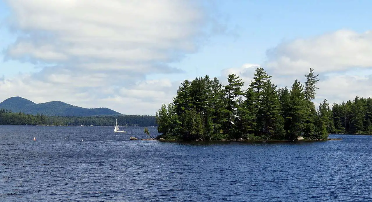
19. Raquette Lake – the largest natural lake in the Adirondacks
Raquette Lake is the largest natural lake in Adirondacks. The lake has a surface area of 1,728 square kilometers.
Total shoreline length of the lake is 159km. This lake has a water volume of 29 cubic miles. The maximum depth of the lake is 95 feet.
Raquette Lake is one of the Adirondack Park’s crown jewels, named after a massive stack of racquets (French for snowshoes) discovered on a hill where South Inlet meets the lake.
Raquette Lake is the biggest natural lake in the Adirondacks, with slightly over 100 miles of beautiful, pine-covered shoreline.
The Hamlet of Raquette Lake is a charming little community with old world, small-town charm, built on a peninsula on the lake’s southwestern bay.
William West Durant began building opulent campgrounds in the late 1800s, which would provide the foundation for the renowned Adirondack Great Camp Style of Architecture.
The camps were wealthy tycoons’ vacation homes, such as Alfred Vanderbilt’s, JP Morgan’s, and Collis P. Huntington’s. Today, visitors to Raquette Lake may learn about these historic settlements and take a tour of the lake on the W.W. Durant, a magnificent steamboat replica.
Nearby is Great Camp Sagamore, a 27-building National Historic Landmark where tourists may take a day tour or overnight on site to experience what life was like in the Great Camps.
Raquette Lake is a popular destination for hikers, campers, boaters, and history and architectural buffs.
Raquette Lake provides a true Adirondack experience for guests and locals alike, from a leisurely boat trip on the lake’s beautiful waters in the summer to snowmobiling through the hamlets plentiful snowfall in the winter.
As we pass Echo, you’ll note that no two structures are similar.
Every single one of them is unique. If you’re an architecture student, you’ll notice that this is a sign that the structures were constructed over a long period of time.
It’s a safe bet that if you find buildings that are grouped and have the same basic design, they were constructed one after the other.
Echo’s structures were constructed over a lengthy period of time.
The earliest log buildings are those closest to the dock.
The following six generations of Lounsbury who owned and used this land constructed all of the other structures down the coast and back.
20.Fulton Chain of Lakes – Also known as: Fulton Lakes, Fulton Chain
Fulton Chain of Lakes are also known as Fulton Lakes or Fulton Chain.
The lake has a surface area of 14.8 square kilometers. Total shoreline length of the lake is 178km.
This lake has a water volume of 6.8 billion US Gallons. The maximum depth of the lake is 82 feet.
The Fulton Chain of Lakes is a historically significant, picturesque, and breathtakingly beautiful area.
Each of the eight lakes has a fascinating history, and they are wonderful locations to visit today. Paddle, boat, camp, fish, and more are all options.
The Fulton Chain of Lakes starts with Eight Lake and finishes at the Old Forge Dam in Old Forge, about 15 miles northeast of Old Forge.
The outflow from Eight Lake flows into Seventh and Sixth Lakes, a 0.4-billion-cubic-foot reservoir created by the Sixth Lake Dam, along a 1-mile-long natural waterway.
The dam’s outflow goes for roughly 0.5 miles down the river into Fifth Lake near the hamlet of Inlet, then through the “Channel” in Inlet into Fourth Lake.
The Old Forge Reservoir, which forms the first through fifth lakes, is a one-billion-cubic-foot reservoir produced by the Old Forge Dam, which is located about 11 miles southwest of Inlet and Fifth Lake.
The Chain’s largest lake is Fourth Lake. At its southern extremity, about 5-miles from Inlet, it links to Third Lake by another small navigable canal.
The navigable link between First Lake and the Old Forge Dam is the Narrows, a 1.3-mile-long canal with the Old Forge Pond at its end.
The simplest place to launch is in Fourth Lake’s Inlet. This is a big, flat launch that can accommodate both motorboats and paddlers.
Old Forge, a neighboring town, provides an alternative route. Each of the lakes, Seventh and Eighth, has its own launch.
The famed 16-mile Fulton Chain is a popular tourist destination. The canal runs from First Lake to Fifth Lake and is dotted with summer villas.
The Sixth and Seventh Lakes are linked as well. A one-mile haul from the shore of Eighth Lake connects you to Raquette Lake and northern pathways.
The Northern Forest Canoe Trail begins at Old Forge Ponds.
Following Fifth Lake, two carries link the remaining, less-developed lakes. They have a number of lean-tos and campsites.
If a camper’s selected site is more than 150 feet from a road, path, or water body, primitive camping is permitted in the Fulton Chain Wild Forest.
Fishing This is a fantastic fishing spot, featuring some of the greatest angling in the whole Fulton Chain Wild Forest.
Fulton Lake is a popular destination for lake trout fishing in the summer and ice fishing in the winter.
Atlantic salmon, rainbow trout, yellow perch, pumpkinseed, northern pike, tiger musky, smallmouth bass, largemouth bass, rainbow smelt, rock bass, and brown bullhead are among the other species targeted by fishermen in these waterways.
Because of the large number and variety of walks accessible in the Adirondack Park, hiking is a widely popular pastime.
From the High Peaks to the comparatively flat treks of Sis and Bub, there are a variety of hikes to choose from.
Due to the spectacular views over the whole Fulton Chain of Lakes, Bald Mountain is one of the most popular mountains to walk not just in the Fulton Chain of Lakes, but also in the Adirondacks as a whole.
Final words
Now you are aware about 20 largest lakes that you can find in the state of New York as of now. While keeping these facts in mind, you can visit the lakes and explore their beauty. All these lakes have a rich history behind them. On top of that, you will also be able to find excellent recreational activities available at these lakes to enjoy as well.
Proud owner of https://travelyouman.com/